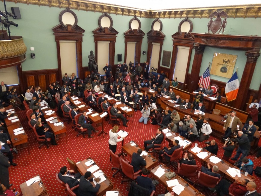
The City Council Chambers at City Hall (Photo: NYLCV)
Aug. 3, 2022 By Christian Murray
The NYC Districting Commission is calling on residents to testify as to the proposed new council districts it released last month.
The commission, which unveiled the preliminary maps for all 51 council districts on July 15, is holding hearings on the draft maps in each borough this month.
The Queens hearing is scheduled to take place at the Museum of the Moving Image (MOMI), located at 36-01 35 Ave., on Aug. 16. from 5:30 p.m. to 9 p.m. Meetings are also scheduled in the Bronx, Staten Island, Brooklyn and Manhattan– on Aug. 17, 18, 21 and 22 respectively.
The location of the Queens meeting is apt since 35th Avenue in Astoria—as with much of western Queens—would undergo major change if the draft maps were to be adopted.
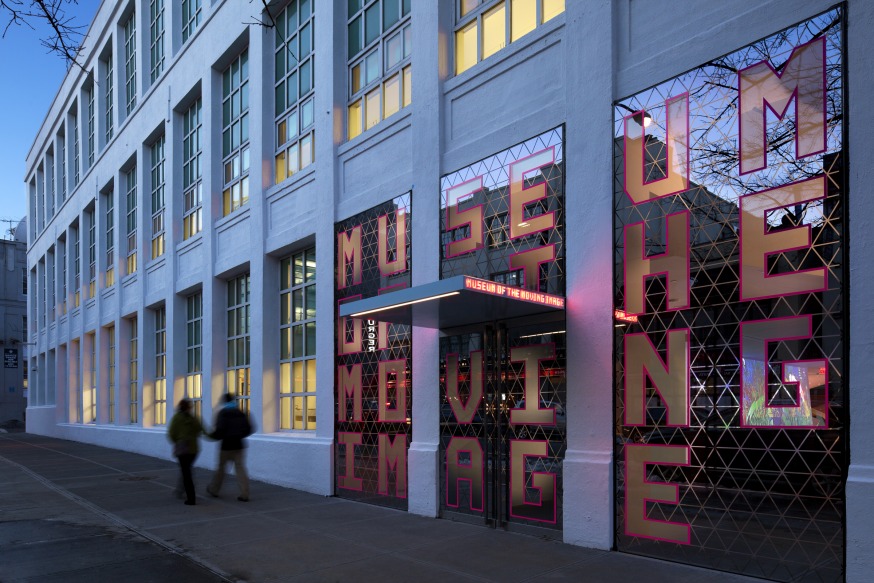
The Museum of the Moving Image, located at 36-01 35 Ave. in Astoria (Photo Courtesy of MOMI)
MoMI is currently located within the confines of the 26th Council District but would become part of Council District 22 if the draft maps are to be adopted.
The maps are vital since all sitting councilmembers have to run for office again next year in the modified districts—having only won two-year terms in 2021. However, more importantly, the district maps will determine how neighborhoods and various ethnic groups within an area are represented.
The district maps are drawn every 10 years to reflect the population count following the U.S. census.
Council District 26–which currently incorporates Sunnyside, Woodside, Long Island City and parts of Astoria—would be cut to bits if the proposed maps are adopted.
The new District 26 map would see much of Astoria removed—along with Queensbridge and Ravenswood—with those areas folded into District 22. Most of Woodside would also be gone, with portions of it falling into Districts 25 and 30.
The 26th district, however, would see the addition of new areas—such as parts of Manhattan near the Queensboro Bridge. It would also include Roosevelt Island.
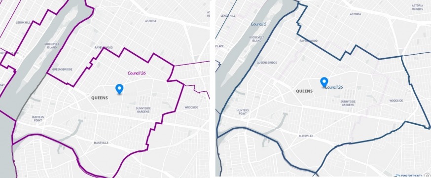
The draft map for Council District 26 (left) with the existing district map on the right. The new map would include Roosevelt Island and a section of the Upper East Side of Manhattan (Source: redistrictingandyou.org)
The fact that the 26th District is changing comes as no surprise since the district has seen its population increase by more than 15 percent between 2010 and 2020—to 183,926—and each of the 51 council districts is required to be approximately 172,882.
However, the revised district has been subject to criticism, since it does appear to conflict with some of the requirements in the City Charter that the redistricting commission must adhere to in creating the new maps.
These requirements include keeping neighborhoods and communities intact; keeping districts compact; limiting crossover districts (a district should not cross borough lines to the maximum extent practicable); avoiding odd-shaped districts; and not splitting voters of the same political party.
Julie Won, who represents the 26th Council District, is opposed to the revised 26th District Council map.
“Looking at the preliminary council maps, it is painfully clear that no one on the NYC District Commission has read the City Charter,” Won said in a statement last month
“The commission chose to separate our communities of color in Long Island City, while also disenfranchising immigrant communities by splitting Woodside into four council districts,” she said.
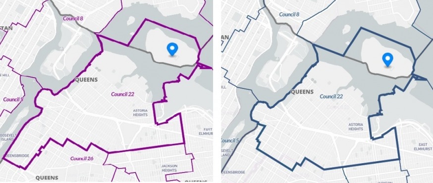
The draft map for Council District 22 (left) with the existing district map on the right. The new map would include Queensbridge and Ravenswood (Source: redistrictingandyou.org)
Meanwhile, District 22—which currently covers most of Astoria as well as East Elmhurst—would not undergo much change, although it would cover a greater portion of Astoria and would include Queensbridge Houses and Ravenswood.
The 22nd district was determined to have 159,611 residents at the time of the 2020 U.S. census and needed to be enlarged given its smaller population size.
The 25th District—which currently covers Jackson Heights and Elmhurst—would see very little change, except for the addition of a few blocks in Woodside.
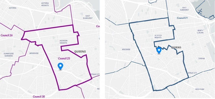
The draft map for Council District 25 (left) with the existing district map on the right. The new map would include a few extra blocks in Woodside (Source: redistrictingandyou.org)
The 30th District map, however, would undergo some change. It would see the loss of parts of Ridgewood, with that loss being made up by additional areas in Woodside.
The commission will come up with a revised draft after the public hearings that will be sent to the city council in September, which it can approve or reject. Should the plan be rejected, it would prompt the commission to hold another round of public hearings.
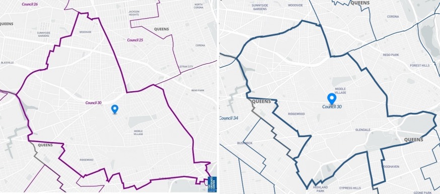
The draft map for Council District 30 (left) with the existing district map on the right. The new map would include expand deeper into Woodside, although a portion of Ridgewood would be lost (Source: redistrictingandyou.org)
The commission, however, would draft the final plans, regardless of the council’s position. The final maps must be filed with the City Clerk no later than Feb. 7, 2023—well in advance of the primary elections.
Council Speaker Adrienne Adams, who represents Jamaica and adjacent areas, is urging the public to come out and weigh in on the plans.
“It is critical for the public to provide input on these first drafts as part of the ongoing redistricting process,” Adams said in a statement. “We strongly encourage all New Yorkers to participate, and we will continue working to ensure communities’ interests are prioritized and protected.”
Meanwhile, Steven Romalewski, a redistricting expert who directs the CUNY Mapping Service at the Center for Urban Research, said he paid close attention to when the maps were drawn 10 years, and noted that it is worth the public’s time providing feedback.
“If you look at the report the commission drew last time, they explained their rationale, and for a number of the districts they made reference to comments that they received…and took them into consideration when drawing the new lines.”
Romanlewski, via the CUNY Graduate Center, has created maps where the public can look at the commission’s preliminary district maps and compare them to the current Council districts via a site called Redistricting & You.
The public can also weigh in on the draft maps by emailing input to publictestimony@redistricting.nyc.gov and they are able to speak remotely at one of the five public hearings the commission is holding this month. For more details, click here.

Featured Events